St Peter’s Street / High Street
Introduction
The King’s bridge originally took its name from the adjacent King’s mill, but it spans the eastern arm of the River Stour which led to it’s alternative name of Eastbridge. Today the view of the river and the surrounding buildings from the bridge form one of the most popular tourist sights in the city. The Eastbridge Hospital on the south side of the bridge is covered elsewhere. Included here are the bridge itself, the current buildings on the old mill site, All Saints’ church (now demolished) and the buildings on the opposite bank known as the Weavers.
History
The mill was granted to St Augustine’s Abbey by King Stephen in 1144. It was repossessed by Henry II who is said to have granted to Rohesia, the sister of Thomas Becket in 1174. It came back into public ownership during the reign of Henry III. All Saints’ Church stood next to the mill, but its original porch and bell tower, which stood on the road itself, were lopped off to enable the widening of King’s bridge by 10 feet in 1769. In 1799 the mill was leased to Alderman James Simmons, and the council agreed for him to demolish it on the basis that it impeded the flow to the downstream Abbot’s Mill which he already owned. He built his own house on the site of the mill, now part of the ASK restaurant, in which he lived from 1802-1807. The church was rebuilt in neo Gothic style in 1828 but made redundant in 1902 and demolished in 1938. The footprint of the east end can be seen outlined in red paving stones at the entrance to Best Lane. (Update 30 October 2012: this pavement has been relaid as part of the Beaney development and the outline of All Saints has sadly disappeared.) The very heavily restored group of early 16th century timber framed buildings on the west end of the bridge with five bays extending along the river is known as the Weavers. This refers to their use as the workshops of the Walloon and Huguenot weavers from the mid 16th century.
What to see:
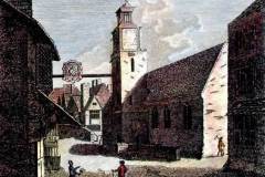
- A print showing King’s bridge and All Saints’ church with it’s porch and bell tower before 1769 (Image 1).
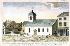
- A print depicting the King’s bridge, the mill, All Saint’s church and the Weavers in 1780, after the demolition of the church porch and bell tower and bridge widening (Image 2).
- The same view today, but with a later extension of James Simmons’ house over the river (Image 3).
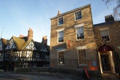
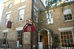
- James Simmons’ original house shown to the right of the later extension, both now clad in mathematical tiles and occupied the the ASK restaurant (Image 4).
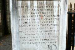
- A stone commemorating the 1769 bridge widening (Image 5).
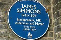
- A modern plaque commemorating James Simmons’ occupation of his house (Image 6).
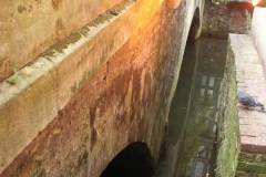
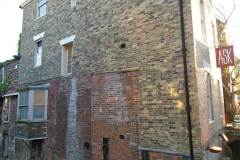
- The arches of the double span stone bridge showing how the flow through the eastern span remains partially blocked and split by a house extension built on the foundations of the original mill, which is still visible above the waterline and contains some of the original brickwork (Image 7).
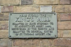
- Plaque commemorating the original site of the King’s mill (Image 8).
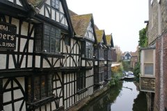
- The view north from the bridge showing the Weavers and the mostly restored ducking stool, last used in 1809 and bearing the legend “Unfaithful wives beware, also butchers, bakers, brewers, apothecaries, and all who give short measure” (Image 9).
- The view over the river showing the foundations of the mill retaining some of the fabric (Image 10).
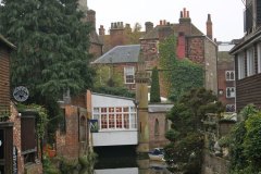
- The view back south from the Friars bridge downstream showing the flows rejoining at a folly in the form of a pinnacle with decorative gun loops, indicating the original width of the river at this point (Image 11).
Access: Viewing from the bridges is possible at all times, but access to the buildings is limited to customers.
Sources: Lyle (2008); Gostling (1825)
SR
