Introduction
St George’s Gate is the only gate in the city walls that is not of Roman origin but its site now sits at the eastern end of the main axis of the city, with Westgate at the other end.
History
In the 10th century a new city main street was formed by demolishing the shambles at the eastern end of the direct line between Westgate and a newly formed gate, creating the streets now known as High Street and St George’s Street. This gate naturally became Newingate (from the Anglo-Saxon ‘aet thaem neowan gate’ – at the new gate) and was probably of simple arched form at first, leading to a cattle market called Rithercheap.
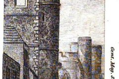
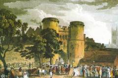
In the very late 14th century the city walls were strengthened and Westgate rebuilt. Newingate was not rebuilt until 1483 as a smaller copy of Westgate and became known as St George’s Gate from the nearby church (Image 1). The Gate consisted of two drum towers of local knapped flint on ashlar plinths with a drawbridge, portcullis and twin leafed wooden doors and a cross constructed just outside (Image 2).
In the mid sixteenth century the upper part was used as a prison, and later as a storehouse. In 1648 during he Civil War the doors were burnt by Parliamentary troops. They were replaced in 1660 by Archbishop Juxon, at the same time as those for Westgate, Burgate and Christchurch Gates.
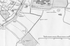
By 1754 the drum towers held the reservoirs for the city’s water supply, but the doors were removed in 1785 and the whole Gate demolished in 1801 to provide more traffic capacity to a new turnpike road to Dover (now New Dover Road) that had been opened in 1790. The reservoir was moved to the nearby bastion tower on the city wall which currently accommodates the Zoar Chapel. Previously traffic to Dover had to turn right and access the Old Dover Road, originally the Roman Watling Street via Riding Gate, via Dover Street. Traffic to Sandwich had to turn left and access the road to Sandwich through Burgate via Ivy Lane (Image 3).
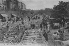
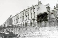
Stones from the demolished gate were used to pave an area for a cattle market over the levelled City ditch as far as Riding Gate (Image 4). This was overlooked from the west by the Georgian houses of St George’s Terrace (Image 5), which had been built on the Roman rampart. On 1st June 1942 the market was destroyed by bombing and in the 1950s the current ring road, roundabout and pedestrian subways were constructed.
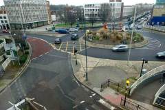
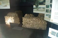
Today there no sign of the Gate except the dark grey paving stones set in the road to mark the plan of the gate, placed there following recent excavations , but easily missed by the passer by. However, the same excavations did reveal a section of the Roman Wall, which is now visible in a small exhibition area within the current wall and towards the modern bus station.
What to see:
- The current roundabout and the dark grey paving stones marking the site of the Gate showing that the access was no wider than a medieval cart and demonstrating why it was demolished (Images 6-7).
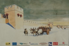
- The exposed remans of the Roman wall (Image 8) together with an artist’s reconstruction (Image 9).
Access
The current roundabout and the Roman wall are visible at all times.
Sources: Lyle(2008); Gostling (1825); Bennett and Houliston (1989)
SR
